Takeoff and GPS Modeling Software for Earthwork and Utility Professionals
See Elevation Pro in Action
- Accurate Earthwork & Utility Takeoff from PDF, CAD, and Drone Data
- Detailed Reports and Graphics
- Build 3D Models
- Easy To Use
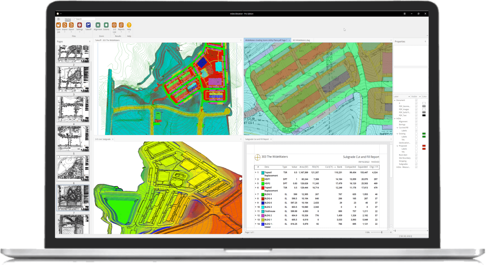
Precise Earthwork and Utility Calculations
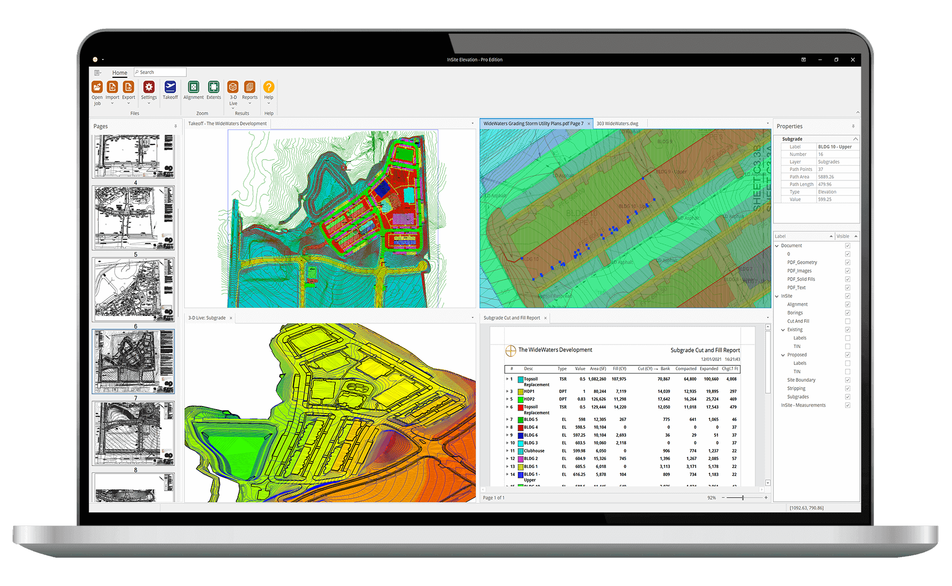
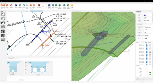
Takeoff from CAD, PDF, and Drone/GPS Data
Multiple aligned documents can be opened with an aligned cursor to make merging data from multiple sources easy.
Align Documents
Indisputable Quantity Validation
Elevation Pro's exclusive Cut & Fill Contour Map and Grid provides advance planning tools and indisputable quantity validation.
View Cut & Fill Validation Tools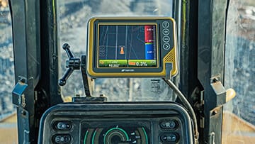
Create GPS Machine Control Models
Export triangulated GPS surfaces to Topcon, Trimble, CAT, Leica, Komatsu and all other machine control systems.
Create Machine Control Models
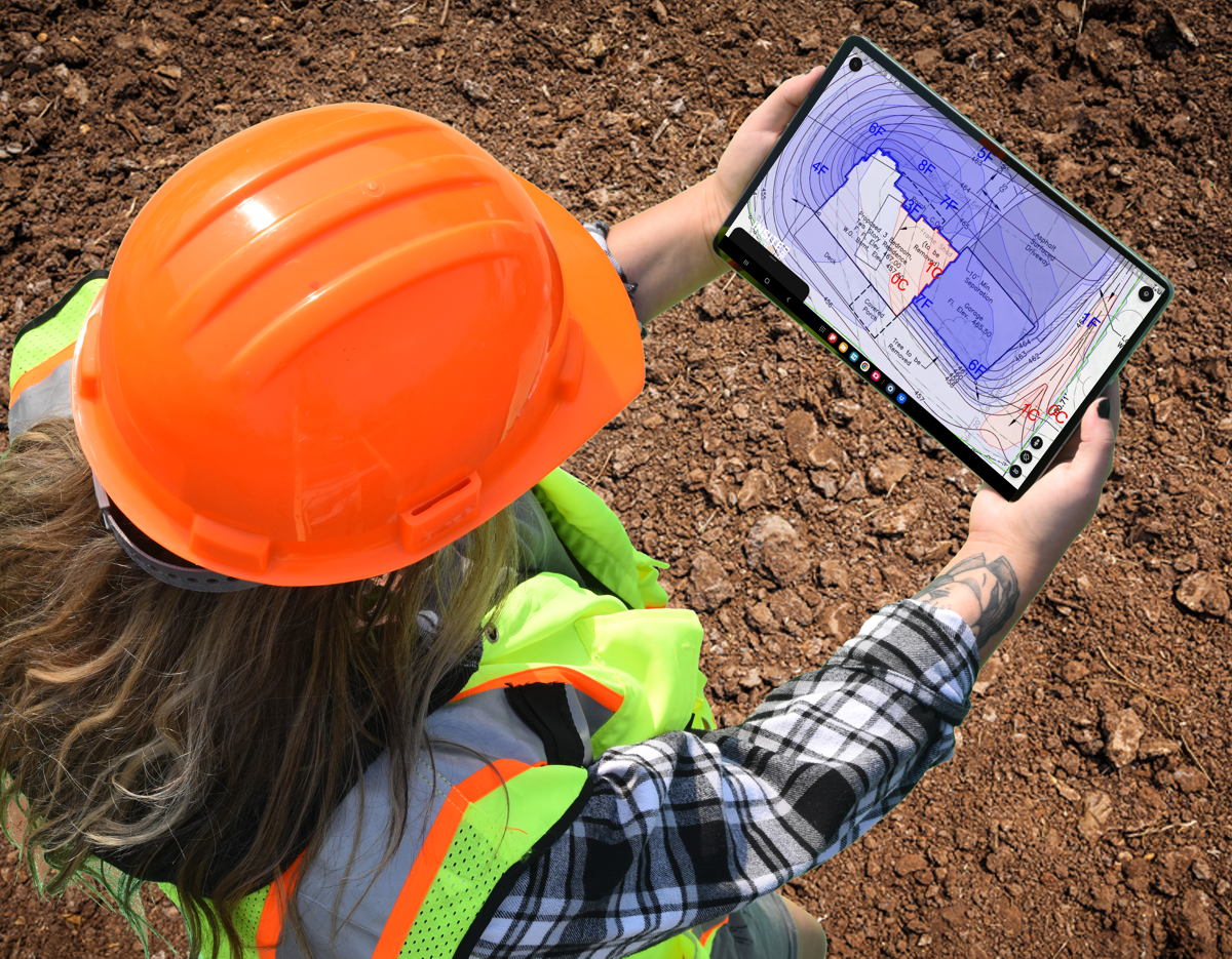
Drone Support
Import drone data for fast-grade verification, production and as-built calculations.
Import Drone Data
TrenchVision 3D
Provide excavation and backfill quantities for sanitary and storm sewers, water, electrical and gas service, using the earthwork contours from your site takeoffs.
Utility Takeoff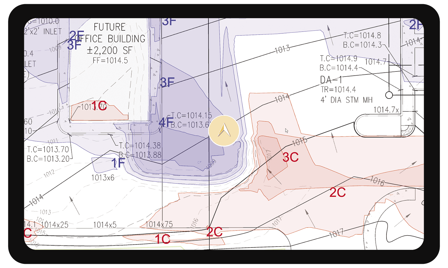
Improve Communication and Collaboration
Export KMZ files to third-party mapping applications like Google Earth, Map Plus, and other geo-browsers with up-to-the-minute job site data.
Export KMZ Files