Graphic Deliverables
InSite Elevation Pro provides detailed hard 3D graphic evidence of all site work calculations which increases confidence for more accurate and tighter bidding.
How It Works
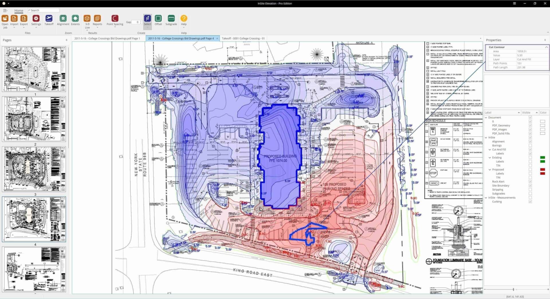
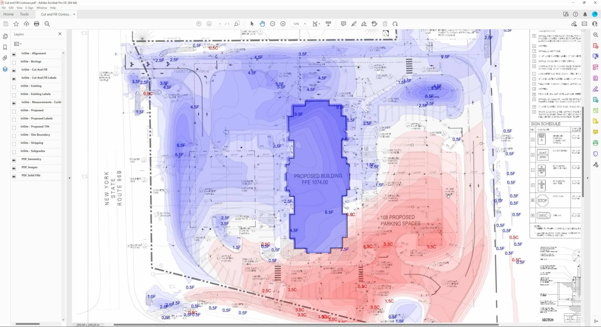
Cut & Fill Contour Map
Cut/fill analysis is an essential aspect of site development and construction projects. By presenting the cut/fill information in the form of contours, adjustable to user defined intervals, trends across the site including significant cut or fill, soil erosion risks, and other critical factors can easily be identified.
Watch the video below to see why cut/fill contours offer significant benefits over grids.
Want to learn more about production cut & fill contours? Click Here.
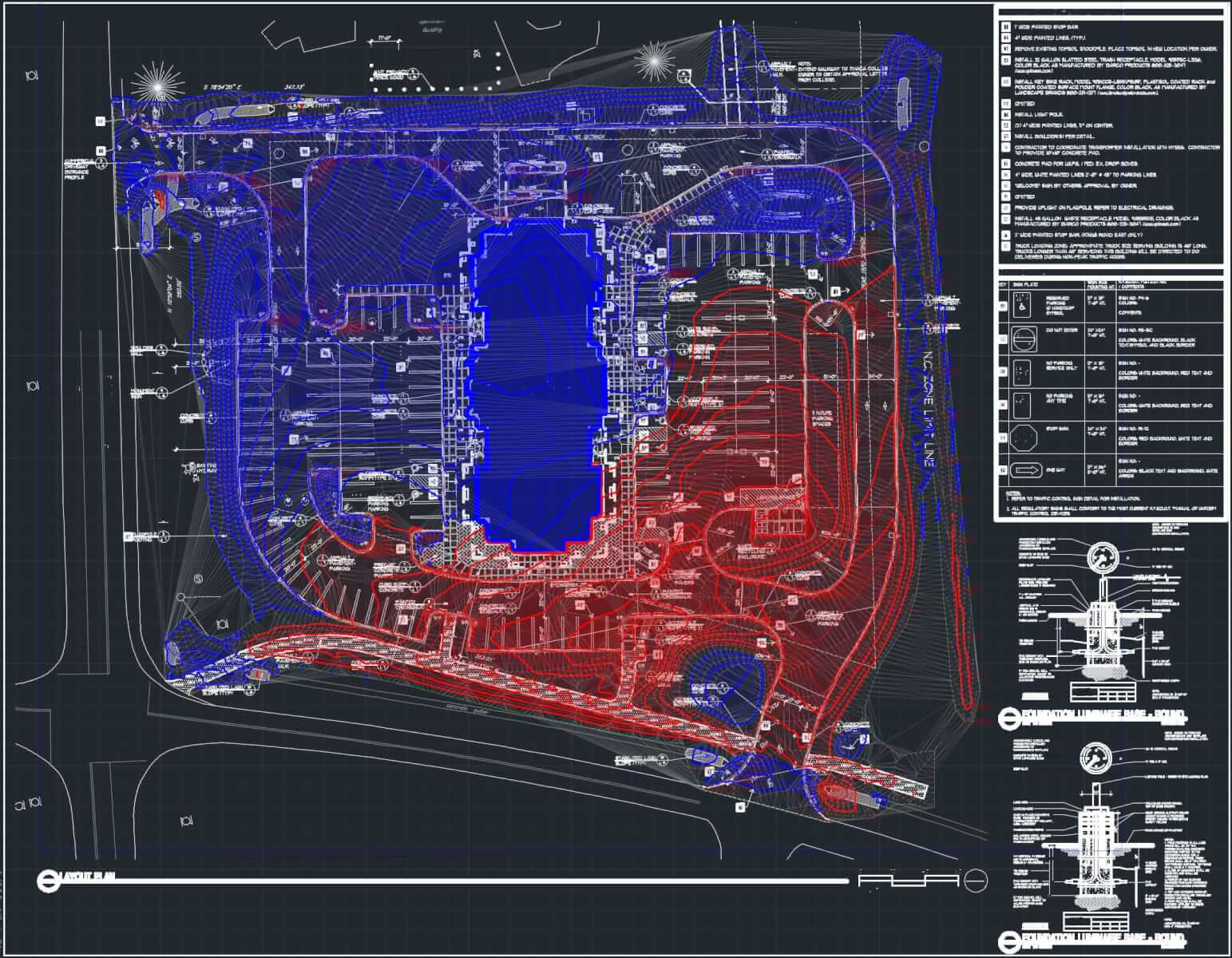
Cut and Fill Grid
Overlay any PDF, DWG, KMZ with Cut & Fill Depth or Cut & Fill Volume at any interval.
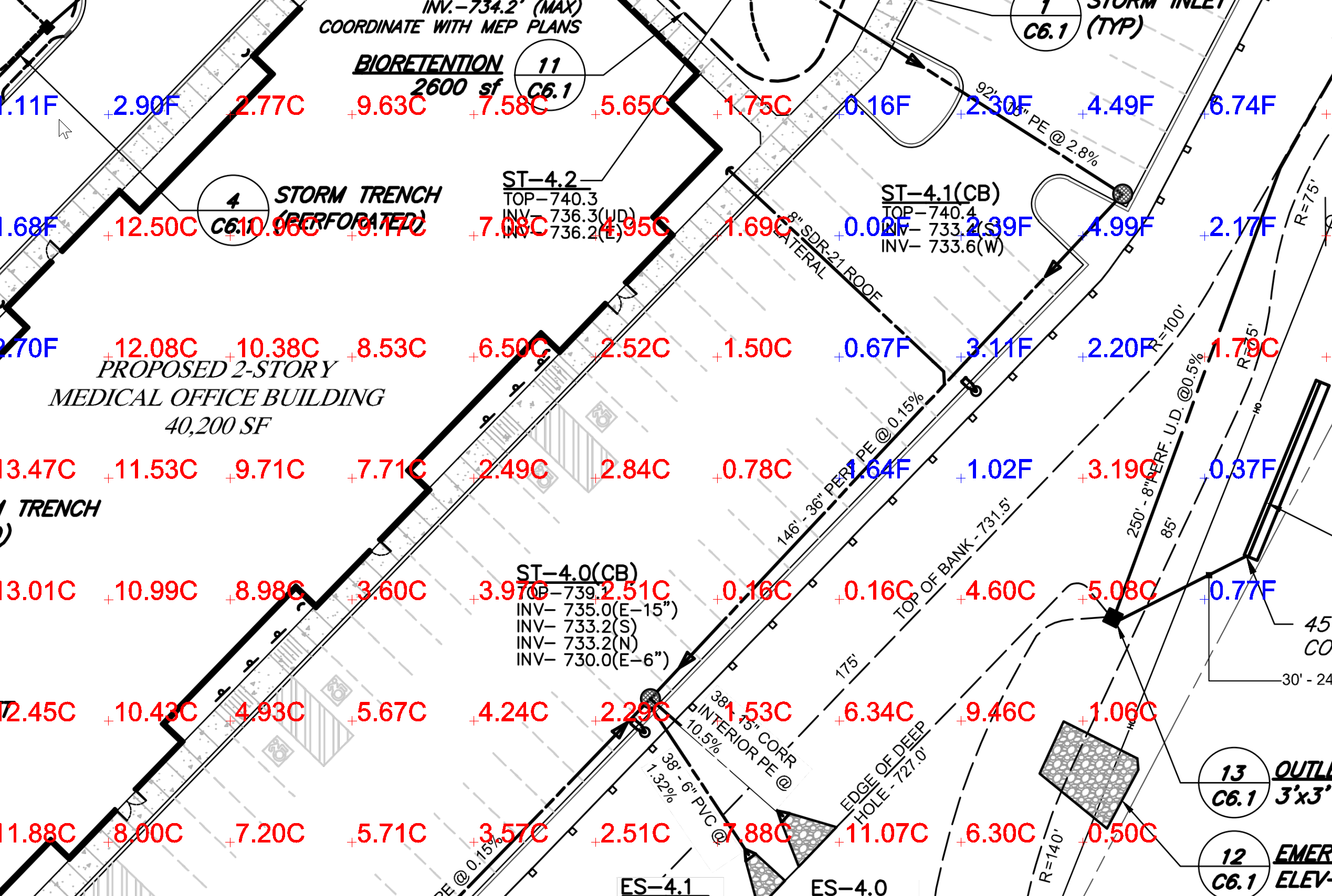
Export to PDF, CAD and KMZ Files
Select Cut & Fill and set the contour interval to plan production. Communicate with your team and prove your numbers to engineers, architects or other contractors.
Cross sections
Cross sections can be taken in X and Y orientations of the site or by selecting a line or series of points to create a profile. Any of the Strata and Stripping Layers can be included with the existing and proposed surfaces.
The plan view below shows a created cross section, ready for PDF export for validation of the site numbers. The blue shading indicates the water table. Export to PDF.

Instant updates with 3-D Live™
View existing, proposed, and subgrade surfaces in a window or on a second monitor. A coordinated cursor between the 2-D and 3-D triangulated surfaces validates input. New additions (contours, spot elevations, subgrades, etc.) and edits are instantly updated with 3-D Live.

Import Google Earth Images
Align Images to the site and overlay any takeoff feature. Use the coordinated cursor to identify challenges.

Export PDF and DWG
Select any Layers from the original PDF or CAD file and any layers from the Elevation takeoff and export to PDF or CAD.
Layers include Stripping and Subgrades regions, triangulation (TIN), Cut & Fill Contours, Area & Length, etc.