Soil Borings
InSite Elevation Pro easily allows soil boring data to be entered to produce cut and fill calculations by strata. Strata surfaces can also be used to indicate removal of unsuitable materials.
How It Works
Watch how InSite Elevation Pro allows soil boring data to be entered to produce cut and fill calculations by strata. Strata surfaces can also be used to indicate removal of unsuitable materials such as rock, water or any other strata.
Enter boring data
Sites with boring samples are entered in simple chart form. Add a row for each strata, add shrinkage (re-compaction) and expansion (loose haul) percentages and the depths to each strata layer. Add shrinkage and Swell factors to calculate bank, recompacted and loose haul volumes.
Optionally add Water Table depths to identify wet areas.

Locate the borings

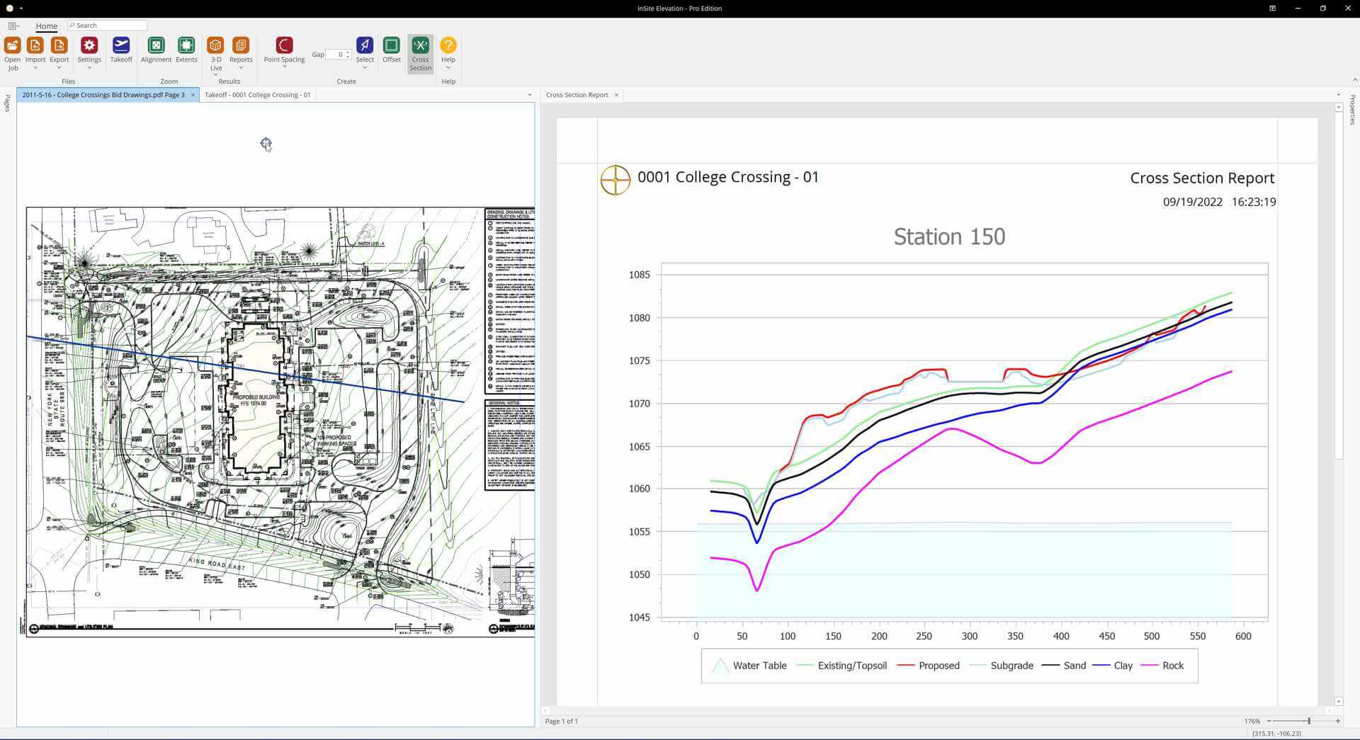
See The Strata
Unexpectedly hitting rock or the water table can be expensive. See exactly where the rock, water or any other strata will be encountered in Cross Sections taken in any direction or following a profile (roads, rails, etc.).
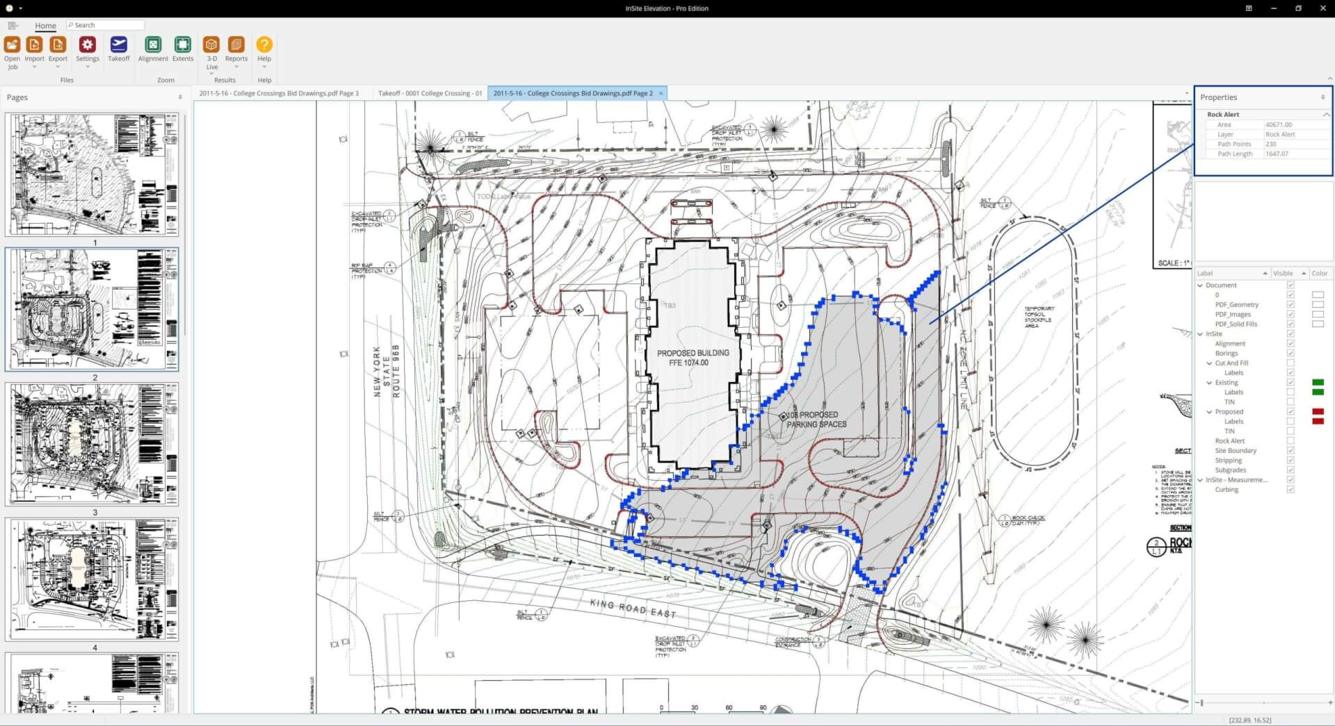
RockAlert™
InSite Elevation Pro allows the surface of any strata encountered during excavation to be identified in plan view with the area indicated. Calculations for blasting have never been easier.